[ This page is taken from the much longer page big-lies.org/jews/articles-on-jews.html | Main big-lies website ]
Birobidzhan (or Birobidjan. Or Birobijan)
Rae West 15 June 2020Russia's land empire (before the Jewish 'Soviet Russia and 'USSR', 1917-1991) started in the same year as the British sea Empire. It went through various phases, though it seems to have expanded fairly continuously, unlike the two-part British Empire. It deserves serious treatment by historians, but of course remains a victim of Jews and is unlikely to get any such serious attention for many years. I'm concerned here mainly with Birobidzhan (English-language spelling) because it was specified as a region ('Oblast') for Jews.
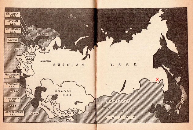 Map of the Soviet Empire in about 1956. Polar projection to fit the huge area on a map; equal latitudes are arcs of circles. Note that the western part of the land empire has all the countries taken over by Jews after 1917, analogously to the USA's east coast states being smaller than the more amorphous western states. They haven't even bothered to add Siberia.
Over to the east, the red 'X' marks Birobidzhan. It seems likely that Stalin and/or other Jews selected a possible Jewish homeland as far away as possible from European Russia. It is on the border with China and had a rail link to the coastal ports of Vladivostok (south) and Nikolayevsk-on-Amur (north, Sakhalin, near Japan.) (From pp. 12-13 Nigel Grant, Soviet Education Pelican paperback, 1964) |
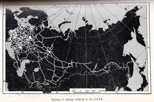 Mid-1950s map of rail lines in what was then the Jewish-ruled Soviet Union. Unmistakable suggestion that the eastern part had few communication links. The trans-Siberian railway dominated. I have found few indications of airports; very likely they were military and secret. Anyway, Birobidzhan clearly was unappealing to Jews with their love of ghettoes, cities, control, and cheap labour.
No wonder Netanyahu's brother screamed at Lady Renouf when she recommended the area as a Jewish homeland, leaving Palestinians in peace. Possibly Stalin picked it as a refuge in case Jews lost support from outside the USSR. This could explain why its existence was censored so effectively. Another possibility is that very-long-established Jews in China were somewhere near. (From p 79 of Economic Geography of the USSR N N Baransky, Foreign Languages Publishing House, Moscow 1956) |
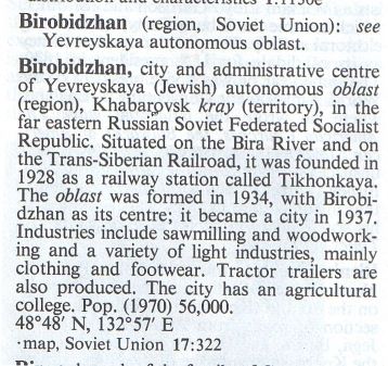 Short entry in 1976 Encyclopaedia Britannica. (Micropedia vol II p 40)
|
Lady Michèlle Renouf campaigns for the reinstatement of Birobizhan in popular awareness, and as a geographical location to put Jews, away fom the middle east. Her several websites include jailingopinions.com/birobidjan.htm on The original Jewish homeland. Michèlle Renouf describes the region as about the size of Switzerland, though I suspect what boundaries there are must be variable. Birobidzan was more or less suppressed by the Jewish media of book and news press, radio, TV, and film. I would guess the same was true in the 'professional' fields of politics, diplomacy, and official geography. The maps that follow are from the 1950s to 1970s. They took some finding. The hefty 1962 Information U.S.S.R. published by Robert Maxwell, and mostly translated from volume 50 of The Great Soviet Encyclopaedia says nothing on it, or on Khabarovsk and Yevreyskaya, more or less synonyms for the area. |
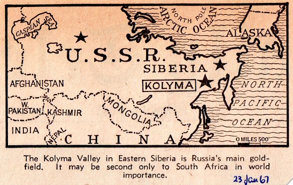 Could this be one reason for the interest in Birobidzhan? Just a guess
|
|
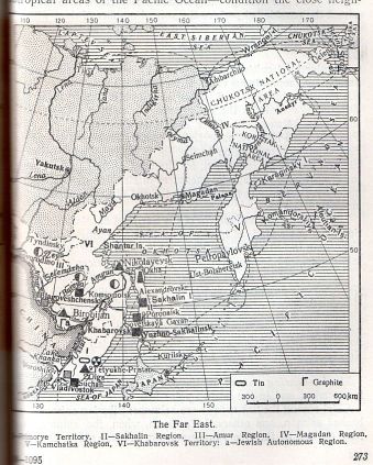
This is page 273 of Economic Geography of the USSR by N N Baransky, 1956. (Foreign Languages Publishing House, Moscow). I'm afraid it's rather blurred, to save bandwidth. However, the bottom left shows Birobijan, with suggestions of industrial activity there. I note that Wikipedia has some information on Birobidzhan. |
I can see no reason why a movement to move Jews to Khazaria, maybe renamed New Israel or something, might not happen, perhaps after ruin of the Middle East.
HTML, research by Rae West